


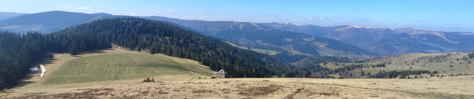
wasserbourg - le sommet du petit ballon

OxygenLT
User
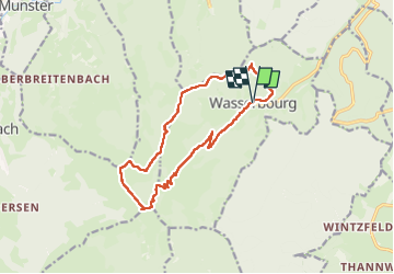

Length
13.3 km

Max alt
1266 m

Uphill gradient
768 m
Km-Effort
24 km

Min alt
527 m

Downhill gradient
769 m
Boucle
Yes
Creation date :
2025-03-28 09:24:35.141
Updated on :
2025-03-28 13:18:35.2
3h42
Difficulty : Medium

FREE GPS app for hiking
 SityTrail
IGN / Geographical institutes
SityTrail Plus
The world is yours!
About
Trail Walking of 13.3 km to be discovered at Grand Est, Haut-Rhin, Wasserbourg. This trail is proposed by OxygenLT.
Photos

Positioning
Country:
France
Region :
Grand Est
Department/Province :
Haut-Rhin
Municipality :
Wasserbourg
Location:
Unknown
Start:(Dec)
Start:(UTM)
362781 ; 5318268 (32U) N.
Comments