


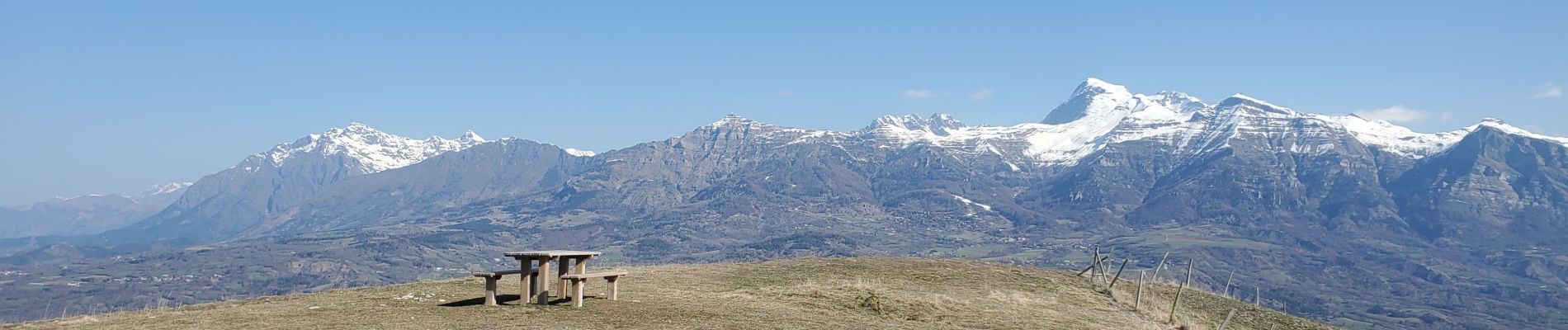
Ancelle puy de manse 4.85m

Danielba
User GUIDE
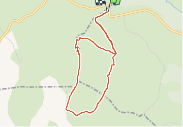

Length
4.6 km

Max alt
1626 m

Uphill gradient
279 m
Km-Effort
8.3 km

Min alt
1345 m

Downhill gradient
276 m
Boucle
Yes
Creation date :
2025-04-05 07:55:31.439
Updated on :
2025-04-05 10:12:08.585
2h04
Difficulty : Easy

FREE GPS app for hiking
 SityTrail
IGN / Geographical institutes
SityTrail Plus
The world is yours!
About
Trail Walking of 4.6 km to be discovered at Provence-Alpes-Côte d'Azur, Hautes-Alpes, Ancelle. This trail is proposed by Danielba .
Photos


Positioning
Country:
France
Region :
Provence-Alpes-Côte d'Azur
Department/Province :
Hautes-Alpes
Municipality :
Ancelle
Location:
Unknown
Start:(Dec)
Start:(UTM)
274779 ; 4945001 (32T) N.
Comments