


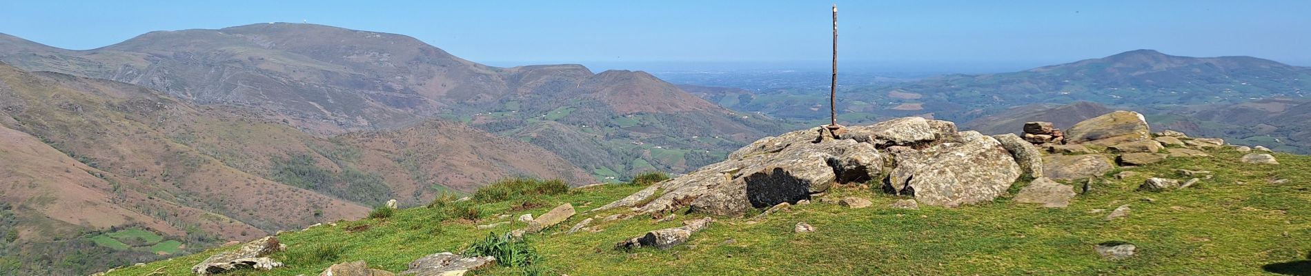
Larla
© OpenStreetMap contributors


3h42
Difficulty : Medium


Length
12 km
Max alt
687 m
Uphill gradient
646 m
Km-Effort
21 km
Min alt
92 m
Downhill gradient
644 m
Boucle
Yes
Creation date :
2025-04-10 07:19:32.767
Updated on :
2025-04-10 13:13:16.582
3h42
Difficulty : Medium
FREE GPS app for hiking
 SityTrail
IGN / Geographical institutes
SityTrail Plus
The world is yours!
About
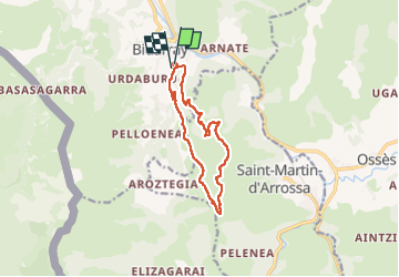
Trail Walking of 12 km to be discovered at New Aquitaine, Pyrénées-Atlantiques, Bidarray. This trail is proposed by ChristopheLefauconnier.
Photos


Positioning
Country:
France
Region :
New Aquitaine
Department/Province :
Pyrénées-Atlantiques
Municipality :
Bidarray
Location:
Unknown
Start:(Dec)
Start:(UTM)
634199 ; 4791419 (30T) N.
Comments