


2015-GranParadiso Jour2

i20
User
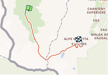

Length
10.2 km

Max alt
3087 m

Uphill gradient
828 m
Km-Effort
21 km

Min alt
2268 m

Downhill gradient
821 m
Boucle
No
Creation date :
2015-07-08 00:00:00.0
Updated on :
2015-07-08 00:00:00.0
4h16
Difficulty : Unknown

FREE GPS app for hiking
 SityTrail
IGN / Geographical institutes
SityTrail Plus
The world is yours!
About
Trail Walking of 10.2 km to be discovered at Aosta Valley, Unknown, Valgrisenche. This trail is proposed by i20.
Description
Refuge Mario Bezzi (2284m) - Col Bassac Dere (3082m) - Refuge Bénévolo (2285m)
Positioning
Country:
Italy
Region :
Aosta Valley
Department/Province :
Unknown
Municipality :
Valgrisenche
Location:
Unknown
Start:(Dec)
Start:(UTM)
345271 ; 5044928 (32T) N.
Comments