


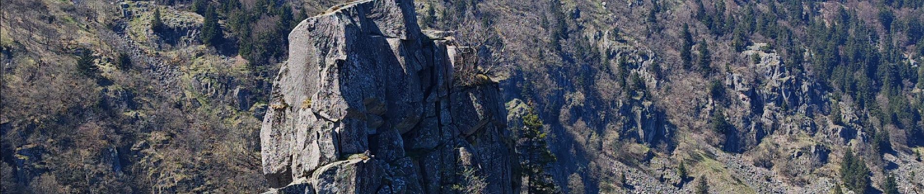
lac blanc, gazon du faing, lac noir, rocher Hans, lac blanc

fbienmuller
User
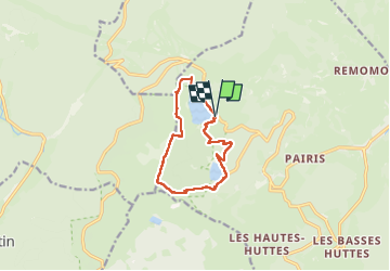

Length
10.3 km

Max alt
1304 m

Uphill gradient
570 m
Km-Effort
17.8 km

Min alt
950 m

Downhill gradient
560 m
Boucle
Yes
Creation date :
2025-04-29 08:11:06.13
Updated on :
2025-04-29 13:55:14.67
4h18
Difficulty : Medium

FREE GPS app for hiking
 SityTrail
IGN / Geographical institutes
SityTrail Plus
The world is yours!
About
Trail Walking of 10.3 km to be discovered at Grand Est, Haut-Rhin, Orbey. This trail is proposed by fbienmuller.
Description
randonnée plutôt abritée (hormis gazon du faing), descente finale plutôt raide et caillouteuse
Photos


Positioning
Country:
France
Region :
Grand Est
Department/Province :
Haut-Rhin
Municipality :
Orbey
Location:
Unknown
Start:(Dec)
Start:(UTM)
358348 ; 5331942 (32U) N.
Comments