


Plan Lâcha - tunnel du Galibier

laurentnecca
User
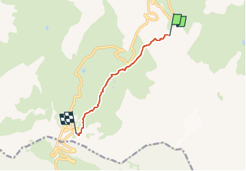

Length
3.5 km

Max alt
2626 m

Uphill gradient
512 m
Km-Effort
8.6 km

Min alt
2104 m

Downhill gradient
0 m
Boucle
No
Creation date :
2025-05-01 07:32:01.93
Updated on :
2025-05-01 11:18:44.037
1h28
Difficulty : Medium

FREE GPS app for hiking
 SityTrail
IGN / Geographical institutes
SityTrail Plus
The world is yours!
About
Trail Touring skiing of 3.5 km to be discovered at Auvergne-Rhône-Alpes, Savoy, Valloire. This trail is proposed by laurentnecca.
Positioning
Country:
France
Region :
Auvergne-Rhône-Alpes
Department/Province :
Savoy
Municipality :
Valloire
Location:
Unknown
Start:(Dec)
Start:(UTM)
298177 ; 4995352 (32T) N.
Comments