


llhotte

michcoq
User
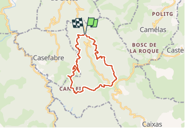

Length
14.4 km

Max alt
688 m

Uphill gradient
502 m
Km-Effort
21 km

Min alt
401 m

Downhill gradient
500 m
Boucle
Yes
Creation date :
2025-05-01 06:09:15.79
Updated on :
2025-05-01 13:12:15.569
4h10
Difficulty : Difficult

FREE GPS app for hiking
 SityTrail
IGN / Geographical institutes
SityTrail Plus
The world is yours!
About
Trail Walking of 14.4 km to be discovered at Occitania, Pyrénées-Orientales, Caixas. This trail is proposed by michcoq.
Positioning
Country:
France
Region :
Occitania
Department/Province :
Pyrénées-Orientales
Municipality :
Caixas
Location:
Unknown
Start:(Dec)
Start:(UTM)
470354 ; 4719499 (31T) N.
Comments