


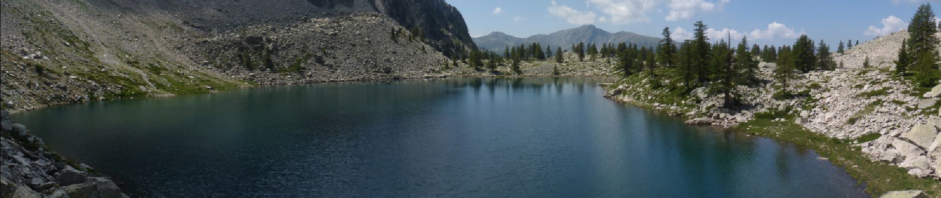
Lac Tavels

aris
User
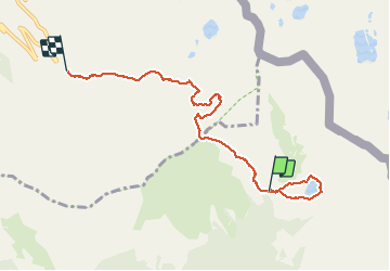

Length
7.1 km

Max alt
2386 m

Uphill gradient
244 m
Km-Effort
10.9 km

Min alt
2083 m

Downhill gradient
418 m
Boucle
No
Creation date :
2015-07-14 00:00:00.0
Updated on :
2020-06-06 22:05:07.922
3h41
Difficulty : Medium

FREE GPS app for hiking
 SityTrail
IGN / Geographical institutes
SityTrail Plus
The world is yours!
About
Trail Walking of 7.1 km to be discovered at Provence-Alpes-Côte d'Azur, Maritime Alps, Valdeblore. This trail is proposed by aris.
Description
Magnifique lac de montagne, d'accès facile par le col Mercière.
La trace GPX ne montre que le retour (et aussi le tour du Lac).
Photos


Positioning
Country:
France
Region :
Provence-Alpes-Côte d'Azur
Department/Province :
Maritime Alps
Municipality :
Valdeblore
Location:
Unknown
Start:(Dec)
Start:(UTM)
355706 ; 4892517 (32T) N.
Comments