


Col du Firstplan - Chemin du Général- Boenlesgrab et retour

patrickbeyrath
User
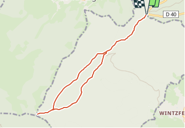

Length
8 km

Max alt
909 m

Uphill gradient
246 m
Km-Effort
11.3 km

Min alt
718 m

Downhill gradient
246 m
Boucle
Yes
Creation date :
2025-05-12 06:24:21.138
Updated on :
2025-05-12 06:32:47.565
2h33
Difficulty : Medium

FREE GPS app for hiking
 SityTrail
IGN / Geographical institutes
SityTrail Plus
The world is yours!
About
Trail Walking of 8 km to be discovered at Grand Est, Haut-Rhin, Soultzmatt. This trail is proposed by patrickbeyrath.
Positioning
Country:
France
Region :
Grand Est
Department/Province :
Haut-Rhin
Municipality :
Soultzmatt
Location:
Unknown
Start:(Dec)
Start:(UTM)
364617 ; 5317814 (32T) N.
Comments