Trail Walking Aiguilles - les lacs du Malrifs - Photo
 amiral13
amiral13

User GUIDE

© OpenStreetMap contributors
Length
Length
11 km
Max alt
Max alt
2740 m
Uphill gradient
Uphill gradient
771 m
Km-Effort
Km-Effort  
21 km
Min alt
Min alt
1963 m
Downhill gradient
Downhill gradient
772 m
Boucle
Boucle
Yes
Creation date :
2015-07-18 00:00:00.0
Updated on :
2015-07-18 00:00:00.0

(0 Reviews)

Walking
Walking
4h44
Difficulty : Unknown

Scan this QR Code to open this trail in the SityTrail application

FREE GPS app for hiking

Logo SityTrail SityTrail

IGN / Geographical institutes

Download SityTrail from the App Store Download SityTrail from Google Play

Logo SityTrail SityTrail World

The world is yours!

Download SityTrail from the App Store Download SityTrail from Google Play Download SityTrail on Huawei AppGallery

About

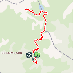
Trail Walking of 11 km to be discovered at Provence-Alpes-Côte d'Azur, Hautes-Alpes, Aiguilles. This trail is proposed by amiral13.

Description

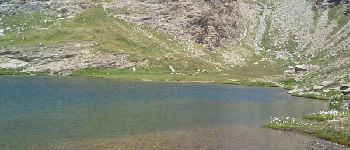
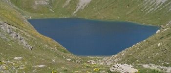
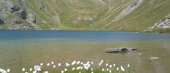
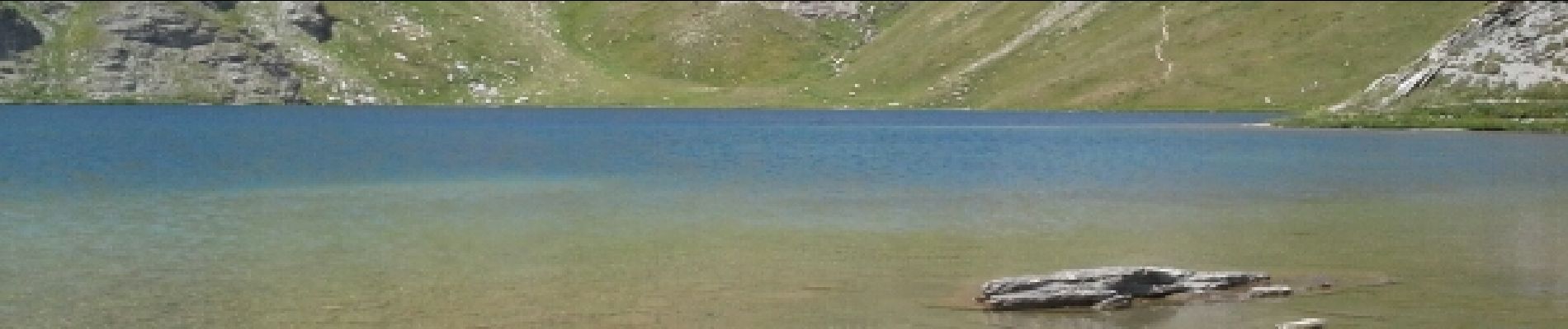
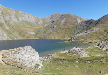
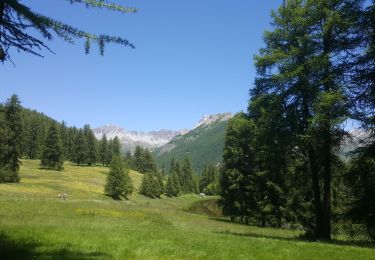
une belle randonnée au milieu des alpages, empruntant un bon sentier qui vous amènera au lac du Grand laus puis au lac Mézan et enfin au Lac du Petit laus.
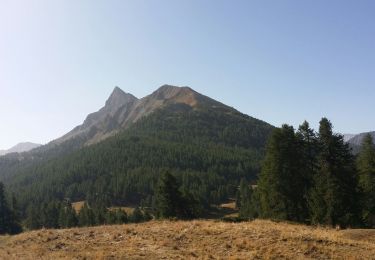
pour les plus courage ils peuvent gravir les 300 mètres les séparant du pic du Malrif.
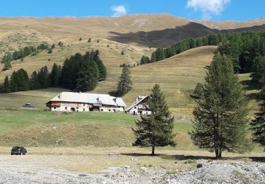
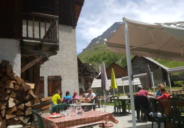
attention, pour se rendre au parking (bergerie du Lombard il faut emprunter une piste de plus de 4 kms à ses risques, la mairie annonce de possibles chutes de pierres et se dégage de toutes responsabilités

Elevation profile

Photos

Points of interest

Point of interest Aiguilles - le petit Laus - Photo
amiral13
AIGUILLES 
Point of interest Aiguilles - le lac Mézan - Photo
amiral13
AIGUILLES 
Point of interest Aiguilles - vue sur le grand Laus - Photo
amiral13
Point of interest Aiguilles - le grand Laus - Photo
amiral13
AIGUILLES 
Point of interest Abriès-Ristolas - le grand Laus - Photo
amiral13
ABRIÈS-RISTOLAS 

Positioning

Country:
France
Region :
Provence-Alpes-Côte d'Azur
Department/Province :
Hautes-Alpes
Municipality :
Aiguilles
Location:
Unknown
Start:(UTM)
331145 ; 4962906 (32T) N.

Trails nearby

Trail Walking Château-Ville-Vieille - Queyras j1 - Photo
Walking
Ninie38MD

Walking

Medium
(1)
Château-Ville-Vieille, Provence-Alpes-Côte d'Azur, Hautes-Alpes, France
19.1 km | 36 km-effort
8h 6min
No
Trail Walking Château-Ville-Vieille - Ville-vieille - Ceillac - Photo
Walking
GUIDE
romanceline

Walking

Medium
Château-Ville-Vieille, Provence-Alpes-Côte d'Azur, Hautes-Alpes, France
17.4 km | 31 km-effort
6h 51min
No
Trail Walking Abriès-Ristolas - Abriès - Aiguilles - Photo
Walking
GUIDE
romanceline

Walking

Difficult
Abriès-Ristolas, Provence-Alpes-Côte d'Azur, Hautes-Alpes, France
16.9 km | 32 km-effort
7h 19min
No
Trail Walking Abriès-Ristolas - Abriès - Aiguilles - Photo
Walking
GUIDE
romanceline

Walking

Difficult
Abriès-Ristolas, Provence-Alpes-Côte d'Azur, Hautes-Alpes, France
16.9 km | 32 km-effort
7h 19min
No
Trail Walking Aiguilles - lacs malrif à partir du lombard - Photo
Walking
francoisBerg

Walking

Medium
Aiguilles, Provence-Alpes-Côte d'Azur, Hautes-Alpes, France
9.8 km | 19.4 km-effort
3h 45min
Yes
Trail Walking Cervières - Le Lac des cordes  - Photo
Walking
Sorriaux

Walking

Difficult
Cervières, Provence-Alpes-Côte d'Azur, Hautes-Alpes, France
10 km | 18.7 km-effort
3h 42min
No
Trail Walking Abriès-Ristolas - J7 Queyras 2022  - Photo
Walking
ETMU5496

Walking

Very difficult
Abriès-Ristolas, Provence-Alpes-Côte d'Azur, Hautes-Alpes, France
19.6 km | 38 km-effort
5h 31min
Yes
Trail Winter toboggan Cervières - refuge Les Fonts à Chalp - Photo
Winter toboggan
jeff2

Winter toboggan

Difficult
Cervières, Provence-Alpes-Côte d'Azur, Hautes-Alpes, France
22 km | 35 km-effort
7h 1min
No
Trail Electric bike Abriès-Ristolas - d'Abries à Fond de cervieres  - Photo
Electric bike
jeff2

Electric bike

Medium
Abriès-Ristolas, Provence-Alpes-Côte d'Azur, Hautes-Alpes, France
14.5 km | 29 km-effort
6h 10min
No


Close
My subscriptions