Trail Mountain bike Wintzenheim - Wintzenheim - Le Stauffen - Col de Marbach - Soultzbach - Photo

Wintzenheim - Le Stauffen - Col de Marbach - Soultzbach

 sit68000
sit68000

User

© OpenStreetMap contributors
Length
Length
23 km
Max alt
Max alt
748 m
Uphill gradient
Uphill gradient
587 m
Km-Effort
Km-Effort  
31 km
Min alt
Min alt
240 m
Downhill gradient
Downhill gradient
586 m
Boucle
Boucle
Yes
Creation date :
2015-07-28 00:00:00.0
Updated on :
2015-07-28 00:00:00.0

(1 Reviews)

Mountain bike
Mountain bike
2h04
Difficulty : Medium

Scan this QR Code to open this trail in the SityTrail application

FREE GPS app for hiking

Logo SityTrail SityTrail

IGN / Geographical institutes

Download SityTrail from the App Store Download SityTrail from Google Play

Logo SityTrail SityTrail World

The world is yours!

Download SityTrail from the App Store Download SityTrail from Google Play Download SityTrail on Huawei AppGallery

About

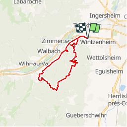
Trail Mountain bike of 23 km to be discovered at Grand Est, Haut-Rhin, Wintzenheim. This trail is proposed by sit68000.

Description

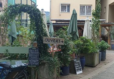
Départ au parking du Poisson Rouge (à la sortie de Wintzenheim en direction de Munster).
Prendre la piste cyclable puis tourner vers Saint Gilles pour prendre le chemin.
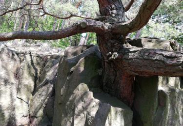
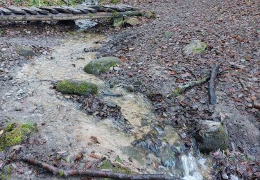
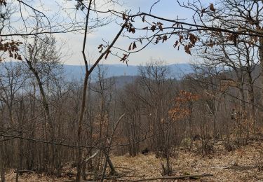
Passer à la fontaine de la Dame Blanche puis au Rocher Turenne.
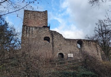
Allez au refuge du Stauffen puis vers le Col de Marbach.
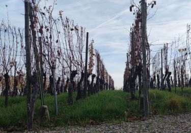
Retour par Soultzbach puis la piste cyclable.

Elevation profile

Positioning

Country:
France
Region :
Grand Est
Department/Province :
Haut-Rhin
Municipality :
Wintzenheim
Location:
Unknown
Start:(UTM)
371776 ; 5326072 (32U) N.

Comments

Please log in to post a review or rate the element


sorti plutôt sympa juste un peu trop de bitume. ..merci


Trails nearby

Trail Walking Wettolsheim - 4 châteaux Wettolsheim Husseren - Photo
Walking
apa

Walking

Medium
(1)
Wettolsheim, Grand Est, Haut-Rhin, France
11.7 km | 17.7 km-effort
4h 28min
No
Trail Walking Ammerschwihr - Trois Épis le rocher du corbeau  - Photo
Walking
zazie

Walking

Easy
(2)
Ammerschwihr, Grand Est, Haut-Rhin, France
4.4 km | 5.7 km-effort
59min
Yes
Trail Walking Eguisheim - suuntoapp-Hiking-2023-12-29T09-05-16Z - Photo
Walking
GUIDE
holtzv

Walking

Medium
Eguisheim, Grand Est, Haut-Rhin, France
22 km | 32 km-effort
7h 16min
Yes
Trail Walking Wintzenheim - Château de Pflixbourg depuis Saint Gilles - Photo
Walking
sit68000

Walking

Easy
(1)
Wintzenheim, Grand Est, Haut-Rhin, France
3.7 km | 6.2 km-effort
1h 21min
Yes
Trail On foot Walbach - wihr au val - le petit hohnack - Photo
On foot
OxygenLT

On foot

Medium
(1)
Walbach, Grand Est, Haut-Rhin, France
15.6 km | 25 km-effort
5h 46min
Yes
Trail Walking Husseren-les-Châteaux - Husseren les Châteaux - Photo
Walking
oscar1

Walking

Easy
Husseren-les-Châteaux, Grand Est, Haut-Rhin, France
12.7 km | 19.1 km-effort
3h 24min
Yes
Trail Road bike Turckheim - Véloroute du vignoble - Photo
Road bike
apa

Road bike

Medium
Turckheim, Grand Est, Haut-Rhin, France
55 km | 61 km-effort
3h 31min
No
Trail Walking Wintzenheim - Boucle de la fontaine de la dame  - Photo
Walking
dudu42

Walking

Medium
Wintzenheim, Grand Est, Haut-Rhin, France
7.9 km | 12.6 km-effort
2h 0min
Yes
Trail Walking Eguisheim - Rando des cinq châteaux  - Photo
Walking
Koralie Werny

Walking

Medium
Eguisheim, Grand Est, Haut-Rhin, France
18.4 km | 28 km-effort
5h 19min
Yes


Close
My subscriptions