


Pralo44

philvidal
User
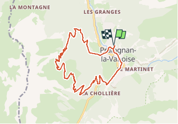

Length
10.6 km

Max alt
2162 m

Uphill gradient
801 m
Km-Effort
21 km

Min alt
1406 m

Downhill gradient
802 m
Boucle
Yes
Creation date :
2025-05-29 08:24:35.0
Updated on :
2025-05-29 12:53:58.198
2h59
Difficulty : Very difficult

FREE GPS app for hiking
 SityTrail
IGN / Geographical institutes
SityTrail Plus
The world is yours!
About
Trail Walking of 10.6 km to be discovered at Auvergne-Rhône-Alpes, Savoy, Pralognan-la-Vanoise. This trail is proposed by philvidal.
Positioning
Country:
France
Region :
Auvergne-Rhône-Alpes
Department/Province :
Savoy
Municipality :
Pralognan-la-Vanoise
Location:
Unknown
Start:(Dec)
Start:(UTM)
321500 ; 5028148 (32T) N.
Comments