


Canigou Alain A

Ada11
User GUIDE

Length
11.3 km

Max alt
2753 m

Uphill gradient
1767 m
Km-Effort
29 km

Min alt
1044 m

Downhill gradient
70 m
Boucle
No
Creation date :
2025-06-07 06:04:59.712
Updated on :
2025-06-08 12:39:45.099
6h31
Difficulty : Difficult

FREE GPS app for hiking
 SityTrail
IGN / Geographical institutes
SityTrail Plus
The world is yours!
About
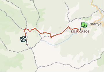
Trail Walking of 11.3 km to be discovered at Occitania, Pyrénées-Orientales, Valmanya. This trail is proposed by Ada11.
Photos

Positioning
Country:
France
Region :
Occitania
Department/Province :
Pyrénées-Orientales
Municipality :
Valmanya
Location:
Unknown
Start:(Dec)
Start:(UTM)
460493 ; 4708903 (31T) N.
Comments