


BBR_Labaroche-Rnes Gestion

RUHLMANN
User
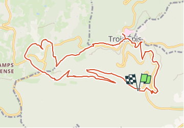

Length
13.2 km

Max alt
799 m

Uphill gradient
583 m
Km-Effort
21 km

Min alt
359 m

Downhill gradient
579 m
Boucle
Yes
Creation date :
2025-06-15 05:47:28.994
Updated on :
2025-08-10 18:24:12.717
4h45
Difficulty : Very difficult

FREE GPS app for hiking
 SityTrail
IGN / Geographical institutes
SityTrail Plus
The world is yours!
About
Trail Walking of 13.2 km to be discovered at Grand Est, Haut-Rhin, Turckheim. This trail is proposed by RUHLMANN.
Positioning
Country:
France
Region :
Grand Est
Department/Province :
Haut-Rhin
Municipality :
Turckheim
Location:
Unknown
Start:(Dec)
Start:(UTM)
368618 ; 5327622 (32U) N.
Comments