


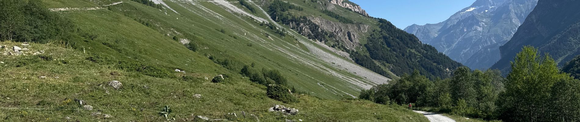
Pralognan - lac blanc

ETMU5496
User
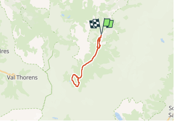

Length
17.3 km

Max alt
2520 m

Uphill gradient
861 m
Km-Effort
29 km

Min alt
1738 m

Downhill gradient
854 m
Boucle
Yes
Creation date :
2025-06-20 07:26:36.0
Updated on :
2025-06-26 15:58:01.628
6h32
Difficulty : Medium

FREE GPS app for hiking
 SityTrail
IGN / Geographical institutes
SityTrail Plus
The world is yours!
About
Trail Walking of 17.3 km to be discovered at Auvergne-Rhône-Alpes, Savoy, Pralognan-la-Vanoise. This trail is proposed by ETMU5496.
Photos


26 photos in total. Please click on a photo to see them all in the gallery.
Positioning
Country:
France
Region :
Auvergne-Rhône-Alpes
Department/Province :
Savoy
Municipality :
Pralognan-la-Vanoise
Location:
Unknown
Start:(Dec)
Start:(UTM)
319484 ; 5023436 (32T) N.
Comments