


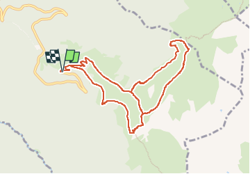
Pkg Val Pelouse - crêtes du Gargoton G2 v2

rolland-a
User

Length
10.7 km

Max alt
2017 m

Uphill gradient
772 m
Km-Effort
21 km

Min alt
1585 m

Downhill gradient
772 m
Boucle
Yes
Creation date :
2025-06-21 14:04:52.224
Updated on :
2025-06-21 14:24:15.881
4h46
Difficulty : Very difficult

FREE GPS app for hiking
 SityTrail
IGN / Geographical institutes
SityTrail Plus
The world is yours!
About
Trail Walking of 10.7 km to be discovered at Auvergne-Rhône-Alpes, Savoy, Arvillard. This trail is proposed by rolland-a.
Description
Pkg Val Pelouse, col de la Perrière, combe de l'Arbet Neuf, crêtes du Gargoton , col puis refuge de la Perrière, pkg de Val Pelouse
Positioning
Country:
France
Region :
Auvergne-Rhône-Alpes
Department/Province :
Savoy
Municipality :
Arvillard
Location:
Unknown
Start:(Dec)
Start:(UTM)
278461 ; 5033327 (32T) N.
Comments