Trail Walking Avioth - Les prairies fleuries et les zones humides de la vallée de la Chiers - Photo

Les prairies fleuries et les zones humides de la vallée de la Chiers

 Nico222
Nico222

User

© OpenStreetMap contributors
Length
Length
24 km
Max alt
Max alt
336 m
Uphill gradient
Uphill gradient
480 m
Km-Effort
Km-Effort  
30 km
Min alt
Min alt
201 m
Downhill gradient
Downhill gradient
479 m
Boucle
Boucle
Yes
Creation date :
2015-07-27 00:00:00.0
Updated on :
2015-07-27 00:00:00.0

(0 Reviews)

Walking
Walking
5h00
Difficulty : Easy

Scan this QR Code to open this trail in the SityTrail application

FREE GPS app for hiking

Logo SityTrail SityTrail

IGN / Geographical institutes

Download SityTrail from the App Store Download SityTrail from Google Play

Logo SityTrail SityTrail World

The world is yours!

Download SityTrail from the App Store Download SityTrail from Google Play Download SityTrail on Huawei AppGallery

About

Trail Walking of 24 km to be discovered at Grand Est, Meuse, Avioth. This trail is proposed by Nico222.

Description

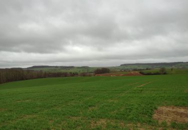
La Chiers et ses affluents forment en Lorraine belge et française un ensemble naturel qui, par la variété de ses biotopes,abrite une grande diversité d'espèces animales et végétales.
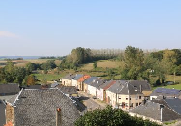
Départ de la basilique d'Avioth.

Elevation profile

Positioning

Country:
France
Region :
Grand Est
Department/Province :
Meuse
Municipality :
Avioth
Location:
Unknown
Start:(UTM)
673062 ; 5493289 (31U) N.

Trails nearby

Trail On foot Breux - La basilique des Champs - Photo
On foot
PRO

On foot

Easy
Breux, Grand Est, Meuse, France
13.1 km | 16.4 km-effort
3h 42min
Yes
Trail On foot Breux - Boucle de promenade à Avioth 2, France - Photo
On foot
PRO

On foot

Easy
Breux, Grand Est, Meuse, France
9.3 km | 11.3 km-effort
2h 33min
Yes
Trail On foot Avioth - Boucle de promenade à Avioth 1, France - Photo
On foot
PRO

On foot

Easy
(1)
Avioth, Grand Est, Meuse, France
7.4 km | 9.2 km-effort
2h 4min
Yes
Trail On foot Montmédy - Boucle de promenade à Montmédy - Photo
On foot
PRO

On foot

Easy
Montmédy, Grand Est, Meuse, France
5.8 km | 7.8 km-effort
1h 46min
No
Trail On foot Meix-devant-Virton - de Sommethonne à Montquintin  - Photo
On foot
dragonchef

On foot

Very difficult
(1)
Meix-devant-Virton, Wallonia, Luxembourg, Belgium
13.8 km | 17.9 km-effort
Unknown
Yes
Trail Walking Thonnelle - Avioth 3 - Photo
Walking
vijl

Walking

Medium
(1)
Thonnelle, Grand Est, Meuse, France
11.7 km | 14.9 km-effort
3h 0min
Yes
Trail Walking Meix-devant-Virton - Gite-de-gaume : Entre France et Belgique  - Photo
Walking
dragonchef

Walking

Difficult
Meix-devant-Virton, Wallonia, Luxembourg, Belgium
26 km | 33 km-effort
4h 56min
Yes
Trail On foot Meix-devant-Virton - “Walk in the hollow of the woods” - Photo
On foot
GUIDE+

On foot

Easy
Meix-devant-Virton, Wallonia, Luxembourg, Belgium
4.7 km | 5.9 km-effort
1h 19min
Yes
Trail Walking Meix-devant-Virton - de sommethonne à florenville - Photo
Walking
dragonchef

Walking

Difficult
Meix-devant-Virton, Wallonia, Luxembourg, Belgium
33 km | 41 km-effort
5h 45min
No


Close
My subscriptions