


Val Cenis Lanserlia

c.gourme
User
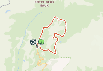

Length
13.2 km

Max alt
2892 m

Uphill gradient
661 m
Km-Effort
22 km

Min alt
2308 m

Downhill gradient
660 m
Boucle
Yes
Creation date :
2025-06-22 07:29:16.0
Updated on :
2025-06-25 19:30:59.46
7h38
Difficulty : Medium

FREE GPS app for hiking
 SityTrail
IGN / Geographical institutes
SityTrail Plus
The world is yours!
About
Trail Walking of 13.2 km to be discovered at Auvergne-Rhône-Alpes, Savoy, Val-Cenis. This trail is proposed by c.gourme.
Positioning
Country:
France
Region :
Auvergne-Rhône-Alpes
Department/Province :
Savoy
Municipality :
Val-Cenis
Location:
Termignon
Start:(Dec)
Start:(UTM)
329917 ; 5021751 (32T) N.
Comments