


La Piolit par la crête de Bonnaparé

frizou83
User
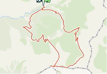

Length
12.7 km

Max alt
2434 m

Uphill gradient
831 m
Km-Effort
24 km

Min alt
1619 m

Downhill gradient
832 m
Boucle
Yes
Creation date :
2025-06-27 14:57:08.93
Updated on :
2025-06-27 14:57:47.257
5h23
Difficulty : Very difficult

FREE GPS app for hiking
 SityTrail
IGN / Geographical institutes
SityTrail Plus
The world is yours!
About
Trail Walking of 12.7 km to be discovered at Provence-Alpes-Côte d'Azur, Hautes-Alpes, Ancelle. This trail is proposed by frizou83.
Positioning
Country:
France
Region :
Provence-Alpes-Côte d'Azur
Department/Province :
Hautes-Alpes
Municipality :
Ancelle
Location:
Unknown
Start:(Dec)
Start:(UTM)
282897 ; 4945271 (32T) N.
Comments