


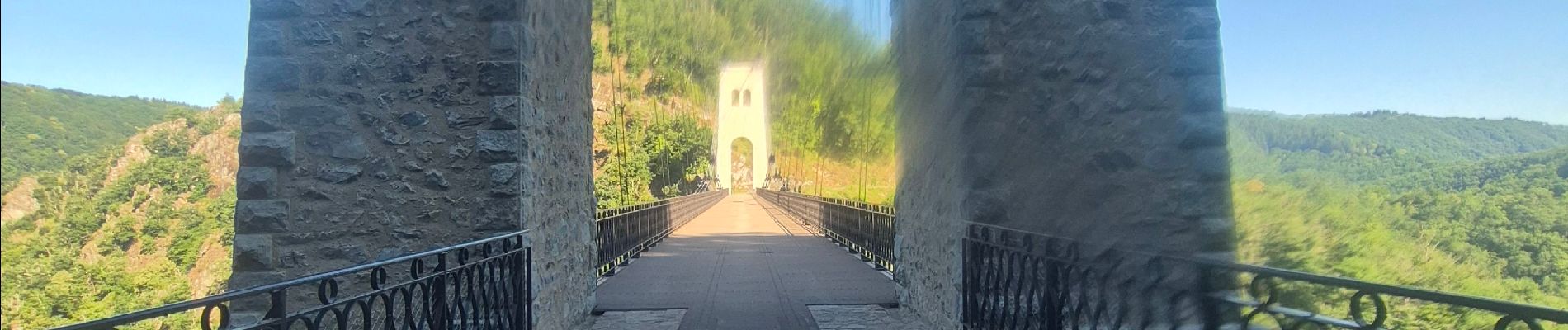
viaduc rochers noir + passerelle

cyrilletaxi
User
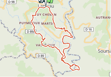

Length
11.1 km

Max alt
534 m

Uphill gradient
429 m
Km-Effort
16.8 km

Min alt
311 m

Downhill gradient
430 m
Boucle
Yes
Creation date :
2025-06-29 05:51:35.37
Updated on :
2025-06-29 09:09:55.601
3h15
Difficulty : Difficult

FREE GPS app for hiking
 SityTrail
IGN / Geographical institutes
SityTrail Plus
The world is yours!
About
Trail Walking of 11.1 km to be discovered at New Aquitaine, Corrèze, Lapleau. This trail is proposed by cyrilletaxi.
Photos


Positioning
Country:
France
Region :
New Aquitaine
Department/Province :
Corrèze
Municipality :
Lapleau
Location:
Unknown
Start:(Dec)
Start:(UTM)
434746 ; 5015814 (31T) N.
Comments