


Teppe verte, col du champet, chapotet - G2

rolland-a
User
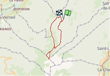

Length
11.2 km

Max alt
2073 m

Uphill gradient
729 m
Km-Effort
21 km

Min alt
1522 m

Downhill gradient
728 m
Boucle
Yes
Creation date :
2025-06-30 12:10:45.113
Updated on :
2025-06-30 12:12:15.037
4h44
Difficulty : Very difficult

FREE GPS app for hiking
 SityTrail
IGN / Geographical institutes
SityTrail Plus
The world is yours!
About
Trail Walking of 11.2 km to be discovered at Auvergne-Rhône-Alpes, Savoy, Saint-Alban-d'Hurtières. This trail is proposed by rolland-a.
Positioning
Country:
France
Region :
Auvergne-Rhône-Alpes
Department/Province :
Savoy
Municipality :
Saint-Alban-d'Hurtières
Location:
Unknown
Start:(Dec)
Start:(UTM)
283263 ; 5037728 (32T) N.
Comments