


Valmorel Roche Blanche Col du Mottet

kephas
User
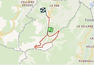

Length
11.4 km

Max alt
2377 m

Uphill gradient
566 m
Km-Effort
21 km

Min alt
1356 m

Downhill gradient
1050 m
Boucle
No
Creation date :
2025-06-30 07:22:18.824
Updated on :
2025-06-30 14:38:00.485
7h15
Difficulty : Medium

FREE GPS app for hiking
 SityTrail
IGN / Geographical institutes
SityTrail Plus
The world is yours!
About
Trail Walking of 11.4 km to be discovered at Auvergne-Rhône-Alpes, Savoy, Les Avanchers-Valmorel. This trail is proposed by kephas.
Positioning
Country:
France
Region :
Auvergne-Rhône-Alpes
Department/Province :
Savoy
Municipality :
Les Avanchers-Valmorel
Location:
Unknown
Start:(Dec)
Start:(UTM)
299773 ; 5035293 (32T) N.
Comments