


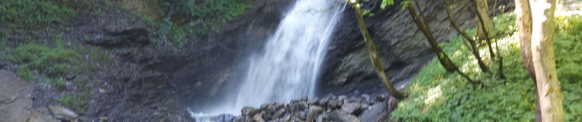
20250701 Vallouise Cascade de la Pissette

Childebert
User
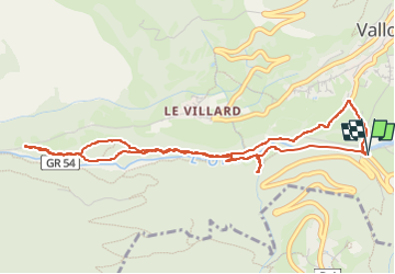

Length
5.5 km

Max alt
1223 m

Uphill gradient
95 m
Km-Effort
6.7 km

Min alt
1160 m

Downhill gradient
100 m
Boucle
Yes
Creation date :
2025-07-01 08:54:28.768
Updated on :
2025-07-03 15:04:33.631
1h32
Difficulty : Medium

FREE GPS app for hiking
 SityTrail
IGN / Geographical institutes
SityTrail Plus
The world is yours!
About
Trail Walking of 5.5 km to be discovered at Provence-Alpes-Côte d'Azur, Hautes-Alpes, Vallouise-Pelvoux. This trail is proposed by Childebert.
Photos


Positioning
Country:
France
Region :
Provence-Alpes-Côte d'Azur
Department/Province :
Hautes-Alpes
Municipality :
Vallouise-Pelvoux
Location:
Vallouise
Start:(Dec)
Start:(UTM)
301299 ; 4968175 (32T) N.
Comments