


BOUCLEDELALANDE-860-3

houbart
User

Length
14.3 km

Max alt
263 m

Uphill gradient
412 m
Km-Effort
19.7 km

Min alt
106 m

Downhill gradient
413 m
Boucle
Yes
Creation date :
2025-07-06 17:19:28.461
Updated on :
2025-07-06 17:20:41.23
4h29
Difficulty : Very difficult

FREE GPS app for hiking
 SityTrail
IGN / Geographical institutes
SityTrail Plus
The world is yours!
About
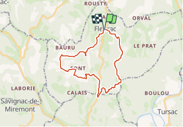
Trail Walking of 14.3 km to be discovered at New Aquitaine, Dordogne, Fleurac. This trail is proposed by houbart.
Positioning
Country:
France
Region :
New Aquitaine
Department/Province :
Dordogne
Municipality :
Fleurac
Location:
Unknown
Start:(Dec)
Start:(UTM)
342549 ; 4985783 (31T) N.
Comments