


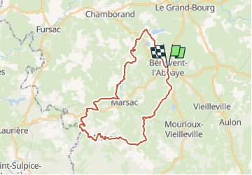
GPX Download: Bénévent l'Abbaye et étang de la Toueille - boucle

fanthou
User

Length
31 km

Max alt
517 m

Uphill gradient
580 m
Km-Effort
39 km

Min alt
349 m

Downhill gradient
583 m
Boucle
Yes
Creation date :
2025-07-07 18:44:09.132
Updated on :
2025-07-07 18:44:48.518
0m
Difficulty : Very easy

FREE GPS app for hiking
 SityTrail
IGN / Geographical institutes
SityTrail Plus
The world is yours!
About
Trail Cycle of 31 km to be discovered at New Aquitaine, Creuse, Bénévent-l'Abbaye. This trail is proposed by fanthou.
Positioning
Country:
France
Region :
New Aquitaine
Department/Province :
Creuse
Municipality :
Bénévent-l'Abbaye
Location:
Unknown
Start:(Dec)
Start:(UTM)
394061 ; 5108164 (31T) N.
Comments