


lac de l'Eychauda

chuck
User

Length
11.3 km

Max alt
2517 m

Uphill gradient
820 m
Km-Effort
22 km

Min alt
1717 m

Downhill gradient
819 m
Boucle
Yes
Creation date :
2025-07-05 06:33:53.056
Updated on :
2025-07-08 12:11:15.933
3h53
Difficulty : Very difficult

FREE GPS app for hiking
 SityTrail
IGN / Geographical institutes
SityTrail Plus
The world is yours!
About
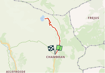
Trail Walking of 11.3 km to be discovered at Provence-Alpes-Côte d'Azur, Hautes-Alpes, Vallouise-Pelvoux. This trail is proposed by chuck.
Photos


Positioning
Country:
France
Region :
Provence-Alpes-Côte d'Azur
Department/Province :
Hautes-Alpes
Municipality :
Vallouise-Pelvoux
Location:
Pelvoux
Start:(Dec)
Start:(UTM)
302050 ; 4975082 (32T) N.
Comments