


circuit 3

chuck
User
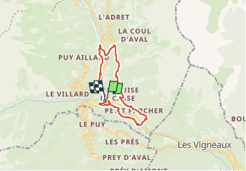

Length
11.2 km

Max alt
1321 m

Uphill gradient
313 m
Km-Effort
15.4 km

Min alt
1119 m

Downhill gradient
312 m
Boucle
Yes
Creation date :
2025-07-08 07:43:16.796
Updated on :
2025-07-08 12:11:17.582
3h49
Difficulty : Difficult

FREE GPS app for hiking
 SityTrail
IGN / Geographical institutes
SityTrail Plus
The world is yours!
About
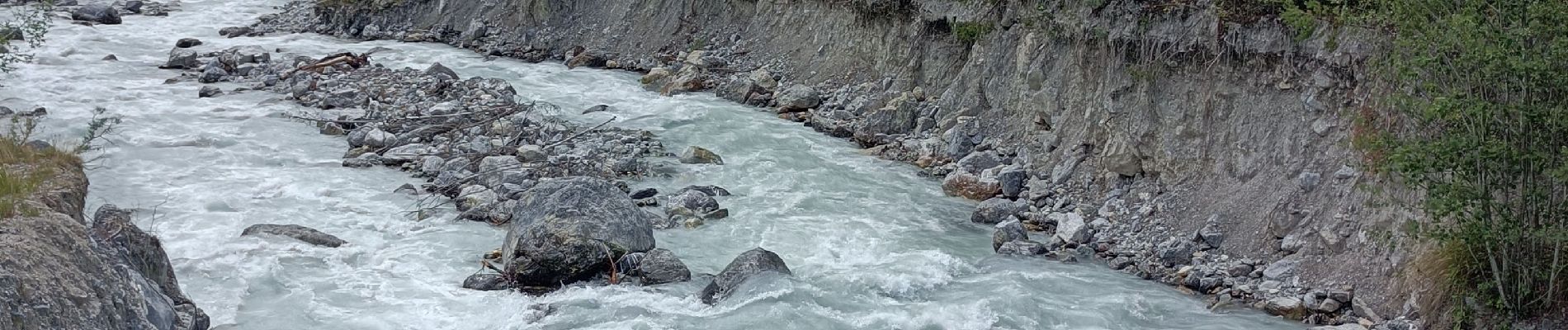
Trail Walking of 11.2 km to be discovered at Provence-Alpes-Côte d'Azur, Hautes-Alpes, Vallouise-Pelvoux. This trail is proposed by chuck.
Photos


Positioning
Country:
France
Region :
Provence-Alpes-Côte d'Azur
Department/Province :
Hautes-Alpes
Municipality :
Vallouise-Pelvoux
Location:
Vallouise
Start:(Dec)
Start:(UTM)
301828 ; 4968104 (32T) N.
Comments