


Bouillon. 2025.07.08

trusgnachjf
User
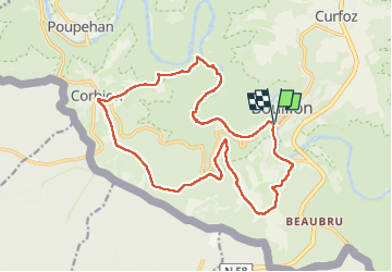

Length
17.9 km

Max alt
442 m

Uphill gradient
523 m
Km-Effort
25 km

Min alt
211 m

Downhill gradient
517 m
Boucle
Yes
Creation date :
2025-07-08 08:01:20.304
Updated on :
2025-07-08 14:13:34.097
6h11
Difficulty : Very difficult

FREE GPS app for hiking
 SityTrail
IGN / Geographical institutes
SityTrail Plus
The world is yours!
About
Trail Walking of 17.9 km to be discovered at Wallonia, Luxembourg, Bouillon. This trail is proposed by trusgnachjf.
Positioning
Country:
Belgium
Region :
Wallonia
Department/Province :
Luxembourg
Municipality :
Bouillon
Location:
Unknown
Start:(Dec)
Start:(UTM)
648623 ; 5517480 (31U) N.
Comments