


BAUGES: TOUR DE LA MONTAGNE DU CHARBON

djeepee74
User
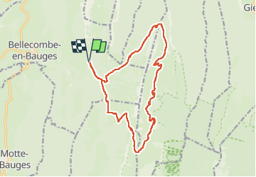

Length
17.9 km

Max alt
1880 m

Uphill gradient
1128 m
Km-Effort
33 km

Min alt
1097 m

Downhill gradient
1129 m
Boucle
Yes
Creation date :
2025-07-12 05:29:45.213
Updated on :
2025-07-19 09:43:10.308
7h10
Difficulty : Difficult

FREE GPS app for hiking
 SityTrail
IGN / Geographical institutes
SityTrail Plus
The world is yours!
About
Trail Walking of 17.9 km to be discovered at Auvergne-Rhône-Alpes, Savoy, Bellecombe-en-Bauges. This trail is proposed by djeepee74.
Description
BOUCLE... live du 20250712
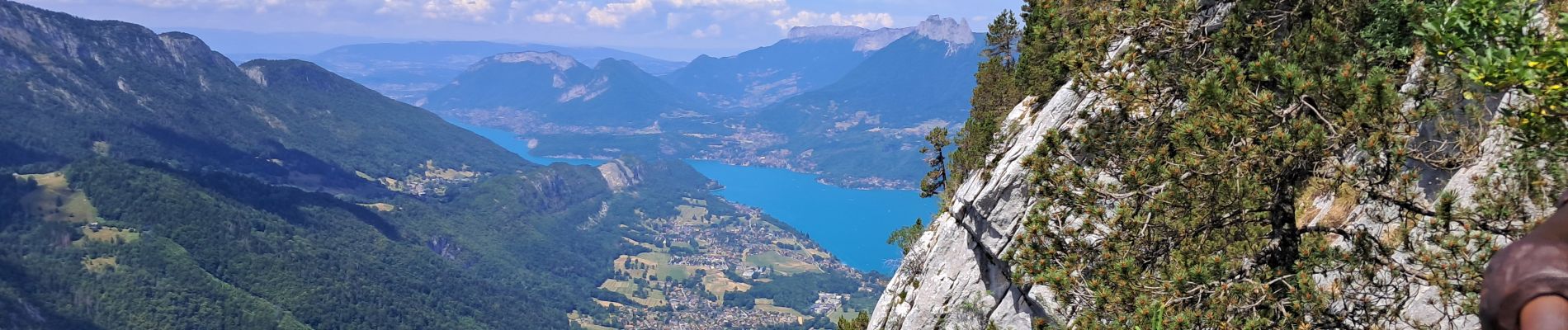
Photos


Positioning
Country:
France
Region :
Auvergne-Rhône-Alpes
Department/Province :
Savoy
Municipality :
Bellecombe-en-Bauges
Location:
Unknown
Start:(Dec)
Start:(UTM)
279675 ; 5068418 (32T) N.
Comments