


GTA jour 4

yvesconnes
User
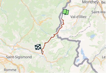

Length
26 km

Max alt
2093 m

Uphill gradient
743 m
Km-Effort
40 km

Min alt
699 m

Downhill gradient
2014 m
Boucle
No
Creation date :
2025-07-12 07:32:10.706
Updated on :
2025-07-12 15:32:12.478
6h07
Difficulty : Very difficult

FREE GPS app for hiking
 SityTrail
IGN / Geographical institutes
SityTrail Plus
The world is yours!
About
Trail Walking of 26 km to be discovered at Valais/Wallis, Monthey, Monthey. This trail is proposed by yvesconnes.
Positioning
Country:
Switzerland
Region :
Valais/Wallis
Department/Province :
Monthey
Municipality :
Monthey
Location:
Unknown
Start:(Dec)
Start:(UTM)
331410 ; 5118415 (32T) N.
Comments