


Beaufortain Roche pourrie

taguette
User
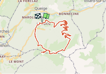

Length
23 km

Max alt
2205 m

Uphill gradient
1679 m
Km-Effort
45 km

Min alt
800 m

Downhill gradient
1680 m
Boucle
Yes
Creation date :
2025-07-12 05:56:13.874
Updated on :
2025-07-12 17:01:15.92
11h03
Difficulty : Very difficult

FREE GPS app for hiking
 SityTrail
IGN / Geographical institutes
SityTrail Plus
The world is yours!
About
Trail Walking of 23 km to be discovered at Auvergne-Rhône-Alpes, Savoy, Queige. This trail is proposed by taguette.
Positioning
Country:
France
Region :
Auvergne-Rhône-Alpes
Department/Province :
Savoy
Municipality :
Queige
Location:
Unknown
Start:(Dec)
Start:(UTM)
302383 ; 5064754 (32T) N.
Comments