


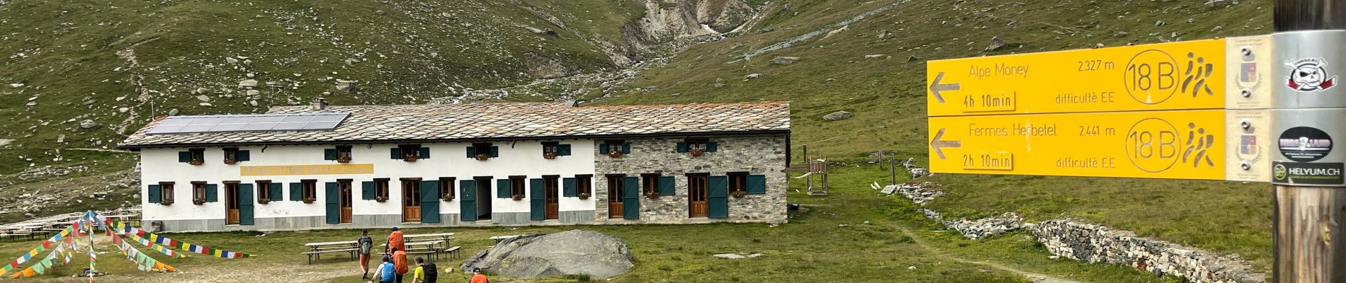
1 Cogne Valnontey Refuge Victorio Sella 2584 m +850 m - 0 m

jouans
User GUIDE
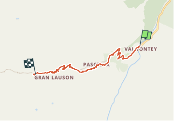

Length
6.2 km

Max alt
2583 m

Uphill gradient
921 m
Km-Effort
15.4 km

Min alt
1661 m

Downhill gradient
3 m
Boucle
No
Creation date :
2025-07-13 11:57:15.0
Updated on :
2025-07-21 11:35:20.816
3h30
Difficulty : Difficult

FREE GPS app for hiking
 SityTrail
IGN / Geographical institutes
SityTrail Plus
The world is yours!
About
Trail Walking of 6.2 km to be discovered at Aosta Valley, Unknown, Cogne. This trail is proposed by jouans.
Description
1er jour Traversée Grand Paradis
Photos


Positioning
Country:
Italy
Region :
Aosta Valley
Department/Province :
Unknown
Municipality :
Cogne
Location:
Unknown
Start:(Dec)
Start:(UTM)
370595 ; 5049553 (32T) N.
Comments