


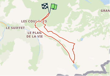
départ ref du petit mot cenis ,lac de la savine

gerardmicheline
User

Length
13.8 km

Max alt
2693 m

Uphill gradient
647 m
Km-Effort
22 km

Min alt
2116 m

Downhill gradient
649 m
Boucle
Yes
Creation date :
2025-07-14 16:35:25.257
Updated on :
2025-07-14 16:35:31.992
5h05
Difficulty : Very difficult

FREE GPS app for hiking
 SityTrail
IGN / Geographical institutes
SityTrail Plus
The world is yours!
About
Trail Walking of 13.8 km to be discovered at Auvergne-Rhône-Alpes, Savoy, Val-Cenis. This trail is proposed by gerardmicheline.
Positioning
Country:
France
Region :
Auvergne-Rhône-Alpes
Department/Province :
Savoy
Municipality :
Val-Cenis
Location:
Bramans
Start:(Dec)
Start:(UTM)
333892 ; 5009328 (32T) N.
Comments