


Pierre Brune - le Chatelard

laurentnecca
User
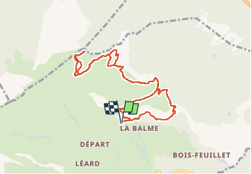

Length
11 km

Max alt
2131 m

Uphill gradient
807 m
Km-Effort
22 km

Min alt
1389 m

Downhill gradient
805 m
Boucle
Yes
Creation date :
2025-07-15 07:53:39.628
Updated on :
2025-07-15 13:43:33.892
4h07
Difficulty : Medium

FREE GPS app for hiking
 SityTrail
IGN / Geographical institutes
SityTrail Plus
The world is yours!
About
Trail Walking of 11 km to be discovered at Auvergne-Rhône-Alpes, Savoy, Jarrier. This trail is proposed by laurentnecca.
Positioning
Country:
France
Region :
Auvergne-Rhône-Alpes
Department/Province :
Savoy
Municipality :
Jarrier
Location:
Unknown
Start:(Dec)
Start:(UTM)
288950 ; 5018632 (32T) N.
Comments