


3 Les Eaux Rousses Col du Manteau 2789 m Refuge Tetra Lyre (Pont) +1150 m - 900 m

jouans
User GUIDE
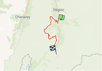

Length
19 km

Max alt
2777 m

Uphill gradient
1257 m
Km-Effort
35 km

Min alt
1670 m

Downhill gradient
940 m
Boucle
No
Creation date :
2025-07-15 06:38:15.0
Updated on :
2025-07-21 11:37:02.087
7h53
Difficulty : Very difficult

FREE GPS app for hiking
 SityTrail
IGN / Geographical institutes
SityTrail Plus
The world is yours!
About
Trail Walking of 19 km to be discovered at Aosta Valley, Unknown, Valsavarenche. This trail is proposed by jouans.
Description
3 ème jour Traversée Grand Paradis
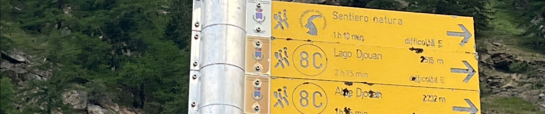
Photos
 +1150 m - 900 m - Photo 1")
 +1150 m - 900 m - Photo 2")
 +1150 m - 900 m - Photo 3")
 +1150 m - 900 m - Photo 4")
 +1150 m - 900 m - Photo 5")
 +1150 m - 900 m - Photo 6")
 +1150 m - 900 m - Photo 7")
 +1150 m - 900 m - Photo 8")
 +1150 m - 900 m - Photo 9")
 +1150 m - 900 m - Photo 10")
 +1150 m - 900 m - Photo 11")
 +1150 m - 900 m - Photo 12")
 +1150 m - 900 m - Photo 13")
 +1150 m - 900 m - Photo 14")
 +1150 m - 900 m - Photo 15")
 +1150 m - 900 m - Photo 16")
 +1150 m - 900 m - Photo 17")
 +1150 m - 900 m - Photo 18")
 +1150 m - 900 m - Photo 19")
 +1150 m - 900 m - Photo 20")
 +1150 m - 900 m - Photo 21")
 +1150 m - 900 m - Photo 22")
22 photos in total. Please click on a photo to see them all in the gallery.
Positioning
Country:
Italy
Region :
Aosta Valley
Department/Province :
Unknown
Municipality :
Valsavarenche
Location:
Unknown
Start:(Dec)
Start:(UTM)
360142 ; 5047561 (32T) N.
Comments