


Beaufortain col de lai refuge du Presset

taguette
User

Length
11.3 km

Max alt
2501 m

Uphill gradient
1033 m
Km-Effort
23 km

Min alt
1787 m

Downhill gradient
359 m
Boucle
No
Creation date :
2025-07-16 06:31:47.29
Updated on :
2025-07-18 17:05:58.693
7h25
Difficulty : Very difficult

FREE GPS app for hiking
 SityTrail
IGN / Geographical institutes
SityTrail Plus
The world is yours!
About
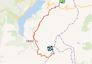
Trail Walking of 11.3 km to be discovered at Auvergne-Rhône-Alpes, Savoy, Beaufort. This trail is proposed by taguette.
Positioning
Country:
France
Region :
Auvergne-Rhône-Alpes
Department/Province :
Savoy
Municipality :
Beaufort
Location:
Unknown
Start:(Dec)
Start:(UTM)
318640 ; 5062589 (32T) N.
Comments