


GTA jour 10

yvesconnes
User
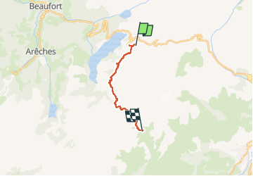

Length
13 km

Max alt
2473 m

Uphill gradient
963 m
Km-Effort
25 km

Min alt
1787 m

Downhill gradient
828 m
Boucle
No
Creation date :
2025-07-18 07:06:09.656
Updated on :
2025-07-19 12:19:26.465
5h25
Difficulty : Difficult

FREE GPS app for hiking
 SityTrail
IGN / Geographical institutes
SityTrail Plus
The world is yours!
About
Trail Walking of 13 km to be discovered at Auvergne-Rhône-Alpes, Savoy, Beaufort. This trail is proposed by yvesconnes.
Positioning
Country:
France
Region :
Auvergne-Rhône-Alpes
Department/Province :
Savoy
Municipality :
Beaufort
Location:
Unknown
Start:(Dec)
Start:(UTM)
317930 ; 5062297 (32T) N.
Comments