


angles

josy31
User
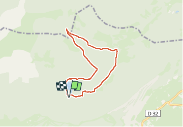

Length
7.2 km

Max alt
1869 m

Uphill gradient
212 m
Km-Effort
10.1 km

Min alt
1667 m

Downhill gradient
212 m
Boucle
Yes
Creation date :
2025-07-20 12:26:54.044
Updated on :
2025-07-21 11:13:45.207
2h04
Difficulty : Medium

FREE GPS app for hiking
 SityTrail
IGN / Geographical institutes
SityTrail Plus
The world is yours!
About
Trail Walking of 7.2 km to be discovered at Occitania, Pyrénées-Orientales, Les Angles. This trail is proposed by josy31.
Positioning
Country:
France
Region :
Occitania
Department/Province :
Pyrénées-Orientales
Municipality :
Les Angles
Location:
Unknown
Start:(Dec)
Start:(UTM)
422296 ; 4715374 (31T) N.
Comments