


Ãtape 5 Beaufortain

Roger Philippe Wallez
User GUIDE
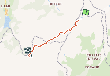

Length
8.3 km

Max alt
2565 m

Uphill gradient
304 m
Km-Effort
13.8 km

Min alt
2057 m

Downhill gradient
731 m
Boucle
No
Creation date :
2025-07-25 06:28:36.0
Updated on :
2025-07-26 14:38:24.162
6h24
Difficulty : Difficult

FREE GPS app for hiking
 SityTrail
IGN / Geographical institutes
SityTrail Plus
The world is yours!
About
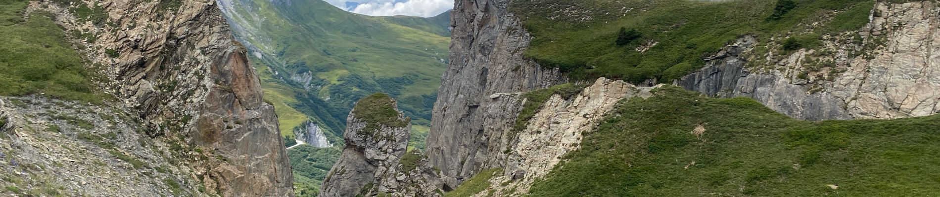
Trail Walking of 8.3 km to be discovered at Auvergne-Rhône-Alpes, Savoy, La Plagne-Tarentaise. This trail is proposed by Roger Philippe Wallez.
Photos


Positioning
Country:
France
Region :
Auvergne-Rhône-Alpes
Department/Province :
Savoy
Municipality :
La Plagne-Tarentaise
Location:
La Côte-d'Aime
Start:(Dec)
Start:(UTM)
317975 ; 5057631 (32T) N.
Comments