


Monte Emilius

mpignon
User
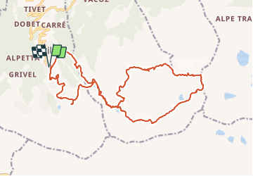

Length
26 km

Max alt
3532 m

Uphill gradient
2377 m
Km-Effort
57 km

Min alt
1859 m

Downhill gradient
2376 m
Boucle
Yes
Creation date :
2017-08-24 00:00:00.0
Updated on :
2017-08-24 00:00:00.0
12h10
Difficulty : Very difficult

FREE GPS app for hiking
 SityTrail
IGN / Geographical institutes
SityTrail Plus
The world is yours!
About
Trail Via ferrata of 26 km to be discovered at Aosta Valley, Unknown, Gressan. This trail is proposed by mpignon.
Positioning
Country:
Italy
Region :
Aosta Valley
Department/Province :
Unknown
Municipality :
Gressan
Location:
Unknown
Start:(Dec)
Start:(UTM)
368462 ; 5060058 (32T) N.
Comments