


Sentier de Beauvais

martin.mondeville
User
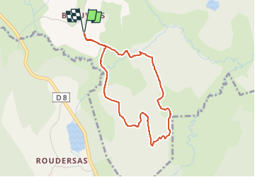

Length
3.9 km

Max alt
723 m

Uphill gradient
108 m
Km-Effort
5.3 km

Min alt
648 m

Downhill gradient
108 m
Boucle
Yes
Creation date :
2025-07-27 14:33:34.0
Updated on :
2025-07-27 15:46:54.538

FREE GPS app for hiking
 SityTrail
IGN / Geographical institutes
SityTrail Plus
The world is yours!
About
Trail of 3.9 km to be discovered at New Aquitaine, Creuse, Saint-Pierre-Bellevue. This trail is proposed by martin.mondeville.
Positioning
Country:
France
Region :
New Aquitaine
Department/Province :
Creuse
Municipality :
Saint-Pierre-Bellevue
Location:
Unknown
Start:(Dec)
Start:(UTM)
414423 ; 5082135 (31T) N.
Comments