


GLIERES: MONUMENT - PACCOT - LES MOUILLES - PISTE SKI FOND - SENTIER DECOUVERTE - CHEZ LA JODE

djeepee74
User
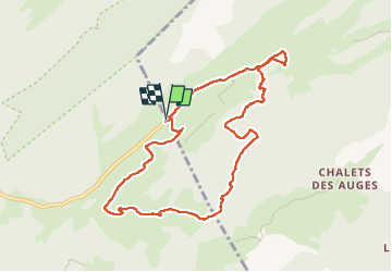

Length
9.2 km

Max alt
1559 m

Uphill gradient
244 m
Km-Effort
12.4 km

Min alt
1385 m

Downhill gradient
241 m
Boucle
Yes
Creation date :
2025-07-30 07:42:10.822
Updated on :
2025-07-31 17:01:44.86
2h49
Difficulty : Easy

FREE GPS app for hiking
 SityTrail
IGN / Geographical institutes
SityTrail Plus
The world is yours!
About
Trail Walking of 9.2 km to be discovered at Auvergne-Rhône-Alpes, Upper Savoy, Fillière. This trail is proposed by djeepee74.
Description
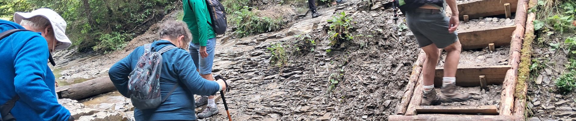
BOUCLE... live du 20250730
Photos

Positioning
Country:
France
Region :
Auvergne-Rhône-Alpes
Department/Province :
Upper Savoy
Municipality :
Fillière
Location:
Thorens-Glières
Start:(Dec)
Start:(UTM)
293248 ; 5093780 (32T) N.
Comments