


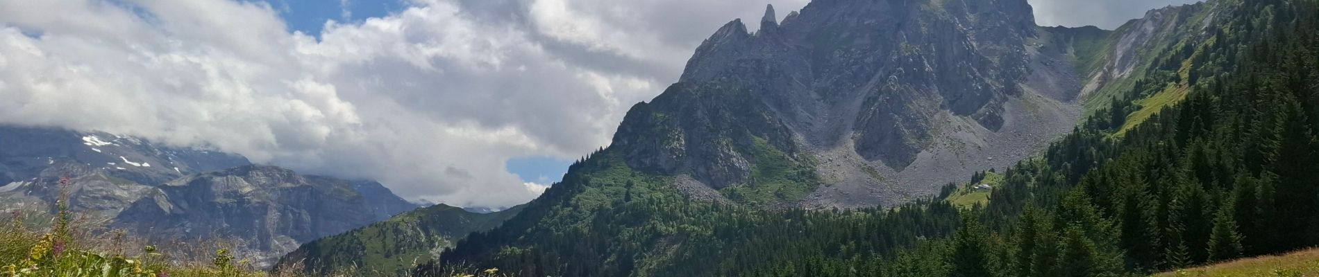
crêtes du Mont Charvet 30 07 2025

bymarc26
User
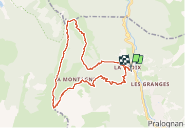

Length
10.9 km

Max alt
2388 m

Uphill gradient
1021 m
Km-Effort
24 km

Min alt
1378 m

Downhill gradient
1027 m
Boucle
Yes
Creation date :
2025-07-30 06:58:39.22
Updated on :
2025-07-30 14:30:14.884
4h32
Difficulty : Difficult

FREE GPS app for hiking
 SityTrail
IGN / Geographical institutes
SityTrail Plus
The world is yours!
About
Trail Walking of 10.9 km to be discovered at Auvergne-Rhône-Alpes, Savoy, Pralognan-la-Vanoise. This trail is proposed by bymarc26.
Description
les crêtes sont à déconseiller aux personnes sujettes au vertige.
Photos


Positioning
Country:
France
Region :
Auvergne-Rhône-Alpes
Department/Province :
Savoy
Municipality :
Pralognan-la-Vanoise
Location:
Unknown
Start:(Dec)
Start:(UTM)
320699 ; 5029439 (32T) N.
Comments