


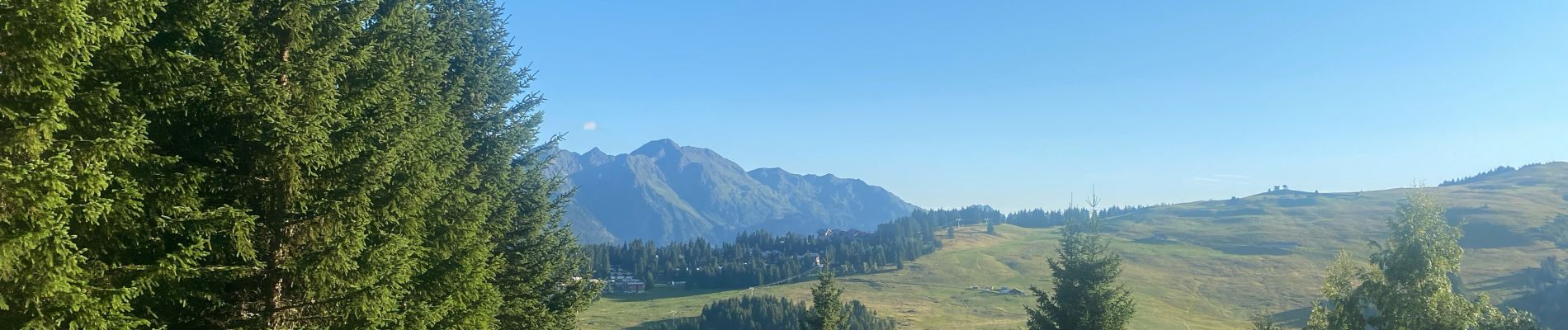
Les Saisies

FOUCAULT
User
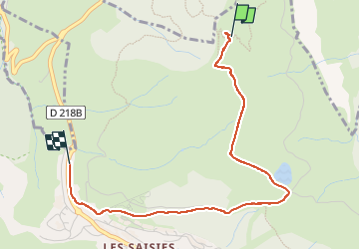

Length
3.4 km

Max alt
1886 m

Uphill gradient
7 m
Km-Effort
4.3 km

Min alt
1658 m

Downhill gradient
225 m
Boucle
No
Creation date :
2025-08-04 16:07:00.0
Updated on :
2025-08-04 18:01:01.347
1h11
Difficulty : Unknown

FREE GPS app for hiking
 SityTrail
IGN / Geographical institutes
SityTrail Plus
The world is yours!
About
Trail Walking of 3.4 km to be discovered at Auvergne-Rhône-Alpes, Savoy, Hauteluce. This trail is proposed by FOUCAULT.
Description
Le 4 août 2025
Photos


Positioning
Country:
France
Region :
Auvergne-Rhône-Alpes
Department/Province :
Savoy
Municipality :
Hauteluce
Location:
Unknown
Start:(Dec)
Start:(UTM)
309313 ; 5071421 (32T) N.
Comments