


Réel 2025 - les trois châteaux

norbertmarteau
User
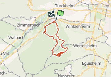

Length
14.7 km

Max alt
624 m

Uphill gradient
622 m
Km-Effort
23 km

Min alt
245 m

Downhill gradient
620 m
Boucle
Yes
Creation date :
2025-08-04 09:07:52.0
Updated on :
2025-08-04 21:07:40.171

FREE GPS app for hiking
 SityTrail
IGN / Geographical institutes
SityTrail Plus
The world is yours!
About
Trail of 14.7 km to be discovered at Grand Est, Haut-Rhin, Wintzenheim. This trail is proposed by norbertmarteau.
Positioning
Country:
France
Region :
Grand Est
Department/Province :
Haut-Rhin
Municipality :
Wintzenheim
Location:
Unknown
Start:(Dec)
Start:(UTM)
371047 ; 5326303 (32U) N.
Comments