


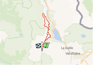
boucle : val claret (Tignes le lac) - refuge LA Martin

perrierf
User


8h47
Difficulty : Very difficult
3h00
Difficulty : Medium

FREE GPS app for hiking
 SityTrail
IGN / Geographical institutes
SityTrail Plus
The world is yours!
About
Trail Walking of 23 km to be discovered at Auvergne-Rhône-Alpes, Savoy, Tignes. This trail is proposed by perrierf.
Description
https://refuge-lamartin.vanoise.com/
belle balade avec pose repas au refuge et possibilté de faire 5/10' de plus pour admirer le glacier sud de la Garraz et le sommet du Mont Pourri
vous pouvez faire un aller retour au plus court ou prendre la variante pour faire une bouble
Positioning
Comments