


Fort Malamo Lac blanc

Michel_Martin
User
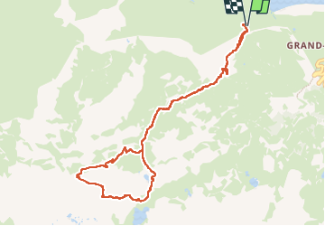

Length
10.4 km

Max alt
2897 m

Uphill gradient
863 m
Km-Effort
22 km

Min alt
2034 m

Downhill gradient
864 m
Boucle
Yes
Creation date :
2025-08-03 05:59:32.193
Updated on :
2025-08-07 13:46:03.48
4h58
Difficulty : Very difficult

FREE GPS app for hiking
 SityTrail
IGN / Geographical institutes
SityTrail Plus
The world is yours!
About
Trail Walking of 10.4 km to be discovered at Auvergne-Rhône-Alpes, Savoy, Val-Cenis. This trail is proposed by Michel_Martin.
Positioning
Country:
France
Region :
Auvergne-Rhône-Alpes
Department/Province :
Savoy
Municipality :
Val-Cenis
Location:
Lanslebourg-Mont-Cenis
Start:(Dec)
Start:(UTM)
338353 ; 5009738 (32T) N.
Comments