


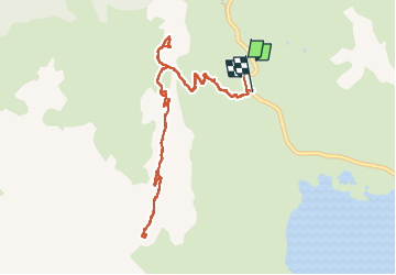
Fort dela Turra/Pas de la Beccia

lmc
User

Length
10.8 km

Max alt
2724 m

Uphill gradient
677 m
Km-Effort
19.8 km

Min alt
2072 m

Downhill gradient
662 m
Boucle
No
Creation date :
2025-08-07 08:59:08.164
Updated on :
2025-08-07 16:15:23.807
6h29
Difficulty : Medium

FREE GPS app for hiking
 SityTrail
IGN / Geographical institutes
SityTrail Plus
The world is yours!
About
Trail Walking of 10.8 km to be discovered at Auvergne-Rhône-Alpes, Savoy, Val-Cenis. This trail is proposed by lmc.
Positioning
Country:
France
Region :
Auvergne-Rhône-Alpes
Department/Province :
Savoy
Municipality :
Val-Cenis
Location:
Unknown
Start:(Dec)
Start:(UTM)
335226 ; 5014180 (32T) N.
Comments