


lac et xx

JPS73
User
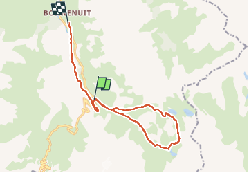

Length
14.5 km

Max alt
2583 m

Uphill gradient
666 m
Km-Effort
24 km

Min alt
1742 m

Downhill gradient
884 m
Boucle
No
Creation date :
2025-08-08 05:59:26.294
Updated on :
2025-08-08 12:27:05.551
4h19
Difficulty : Very difficult

FREE GPS app for hiking
 SityTrail
IGN / Geographical institutes
SityTrail Plus
The world is yours!
About
Trail Walking of 14.5 km to be discovered at Auvergne-Rhône-Alpes, Savoy, Valloire. This trail is proposed by JPS73.
Positioning
Country:
France
Region :
Auvergne-Rhône-Alpes
Department/Province :
Savoy
Municipality :
Valloire
Location:
Unknown
Start:(Dec)
Start:(UTM)
298176 ; 4996189 (32T) N.
Comments