


valloire > Bonne nuit > Col du Goléon

catduv
User
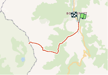

Length
14.7 km

Max alt
2855 m

Uphill gradient
1109 m
Km-Effort
30 km

Min alt
1751 m

Downhill gradient
1116 m
Boucle
Yes
Creation date :
2025-08-12 06:22:48.236
Updated on :
2025-08-16 20:52:30.027
4h49
Difficulty : Medium

FREE GPS app for hiking
 SityTrail
IGN / Geographical institutes
SityTrail Plus
The world is yours!
About
Trail Walking of 14.7 km to be discovered at Auvergne-Rhône-Alpes, Savoy, Valloire. This trail is proposed by catduv.
Positioning
Country:
France
Region :
Auvergne-Rhône-Alpes
Department/Province :
Savoy
Municipality :
Valloire
Location:
Unknown
Start:(Dec)
Start:(UTM)
297384 ; 4998706 (32T) N.
Comments